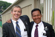
 Elder Rich had sent home a map., showing the area of Pucallpa. On it, he mentioned that the Familia Tiquilahuanca lived about 35 kilos west. I got on Google Earth, and followed the road for that distance, and came upon the "town" of Campo Verde. I wondered how the Elders got there? I hoped it wasn't by "moto". Thank goodness for these reassuring words....
"Campo Verde is a branch that we work in. We go in a taxi, not in a moto, so don’t worry!!! It's safer, haha. We had a great talk with the Bishop there this past week, and we're all set to go and get working in the work here in Ucayali."
Ucayali is the "Area" or "Region", Pucallpa is the "City", and Campo Verde would be one of the little "towns".


No comments:
Post a Comment